 erbanner
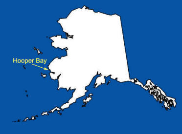 Hooper Bay
Hooper Bay is located 20 miles south of Cape Romanzof, Bay in the Yukon-Kuskokwim Delta. The city is separated into two sections: a developed town site located on gently rolling hills, and a newer section in the lowlands. It lies at approximately 61° 31' N Latitude, 166° 05' W Longitude (Sec. 26, T017N, R093W, Seward Meridian). The community is located in the Bethel Recording District. The area encompasses 9 sq. miles of land.
"Askinuk" or "Askinaghamiut" are the early native names for
Hooper Bay. The village was first reported in 1878 by E.W. Nelson of the U.S. Signal
Service. Nelson sailed with Captain Calvin L. Hooper (After whom the area
was named) aboard the streamer Corwin along with naturalist John
Muir. Nelson and Muir both published their observations of the people and
environment observed along their journey and provide an interesting look into
Alaskans rich history.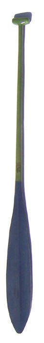
The 1890 Census found 138 persons living in 14 homes. The name Hooper Bay came into common usage after a post office with this name was established in 1934. The present-day Inuit name "Naparagamiut" means "stake village people."
Hooper bay
A special thanks to Robert S. Brown for introducing me to this paddle design and for his continuing service to our nation.
This Hooper bay paddle is shown in Western Red Cedar. The blue and green stained areas are recoated with a satin urethane finish.
Price as shown $135.00
Specifications: L to order. W 12.8 cm
 One of the interesting feature of this paddle is shape of the blade in. Its concave surfaces make it an interesting paddle to experience.